Overview
Geographic Information Systems (GIS) power Earth and human interaction decisions far beyond what we see in internet maps and vehicle navigation devices. Because GIS is a business tool in many organisations, you will be exposed to and acquire practical skills in making electronic maps and analysing geographical data. You will explore mapping concepts, spatial analysis processes and mapping communication standards that are as important today as they were for Gerardus Mercator in the 16th century.
Details
Pre-requisites or Co-requisites
There are no requisites for this unit.
Important note: Students enrolled in a subsequent unit who failed their pre-requisite unit, should drop the subsequent unit before the census date or within 10 working days of Fail grade notification. Students who do not drop the unit in this timeframe cannot later drop the unit without academic and financial liability. See details in the Assessment Policy and Procedure (Higher Education Coursework).
Offerings For Term 1 - 2025
Attendance Requirements
All on-campus students are expected to attend scheduled classes - in some units, these classes are identified as a mandatory (pass/fail) component and attendance is compulsory. International students, on a student visa, must maintain a full time study load and meet both attendance and academic progress requirements in each study period (satisfactory attendance for International students is defined as maintaining at least an 80% attendance record).
Recommended Student Time Commitment
Each 6-credit Undergraduate unit at CQUniversity requires an overall time commitment of an average of 12.5 hours of study per week, making a total of 150 hours for the unit.
Class Timetable
Assessment Overview
Assessment Grading
This is a graded unit: your overall grade will be calculated from the marks or grades for each assessment task, based on the relative weightings shown in the table above. You must obtain an overall mark for the unit of at least 50%, or an overall grade of 'pass' in order to pass the unit. If any 'pass/fail' tasks are shown in the table above they must also be completed successfully ('pass' grade). You must also meet any minimum mark requirements specified for a particular assessment task, as detailed in the 'assessment task' section (note that in some instances, the minimum mark for a task may be greater than 50%). Consult the University's Grades and Results Policy for more details of interim results and final grades.
All University policies are available on the CQUniversity Policy site.
You may wish to view these policies:
- Grades and Results Policy
- Assessment Policy and Procedure (Higher Education Coursework)
- Review of Grade Procedure
- Student Academic Integrity Policy and Procedure
- Monitoring Academic Progress (MAP) Policy and Procedure - Domestic Students
- Monitoring Academic Progress (MAP) Policy and Procedure - International Students
- Student Refund and Credit Balance Policy and Procedure
- Student Feedback - Compliments and Complaints Policy and Procedure
- Information and Communications Technology Acceptable Use Policy and Procedure
This list is not an exhaustive list of all University policies. The full list of University policies are available on the CQUniversity Policy site.
Feedback, Recommendations and Responses
Every unit is reviewed for enhancement each year. At the most recent review, the following staff and student feedback items were identified and recommendations were made.
Feedback from Self-reflection
Review and update learning materials. Some of the materials are dated and based on earlier versions of the GIS software used in the unit.
Review and update all learning materials for this unit. Ensure that the guidelines or procedures provided for mapping purposes are in sync with the current version of the GIS software in use.
Feedback from SUTE
Schedule a weekly tutorial to complement pre-recorded lectures and other materials provided on Moodle.
Schedule a one-hour weekly tutorial to respond to students' questions or provide further guidance on certain aspects of the unit. Consult with the students about the time and day of the tutorial.
Feedback from Self-reflection
Students should be encouraged to download and test the GIS software on their computers early in the term.
Bring forward the requirement for students to download the GIS software used in this unit (ArcGIS Pro) from Week 2 to Week 1 of the term. Before Week 1 of the term, the unit coordinator will email the enrolled students with the links and procedures to download and install the software on their computers. This will give them additional time to test and get familiar with the software. Students having problems accessing and running the software on their computers should contact the unit coordinator and TaSAC for help as soon as possible.
- Replicate a range of mapping operations using GIS data sets.
- Solve introductory spatial analysis problems using GIS data management and manipulation functions.
- Reproduce GIS-based maps that meet cartographic theory, standards and practice.
Nil
Alignment of Assessment Tasks to Learning Outcomes
| Assessment Tasks | Learning Outcomes | ||
|---|---|---|---|
| 1 | 2 | 3 | |
| 1 - Practical Assessment - 20% | |||
| 2 - Practical Assessment - 40% | |||
| 3 - Practical Assessment - 40% | |||
Alignment of Graduate Attributes to Learning Outcomes
| Graduate Attributes | Learning Outcomes | ||
|---|---|---|---|
| 1 | 2 | 3 | |
| 1 - Communication | |||
| 2 - Problem Solving | |||
| 3 - Critical Thinking | |||
| 4 - Information Literacy | |||
| 5 - Team Work | |||
| 6 - Information Technology Competence | |||
| 7 - Cross Cultural Competence | |||
| 8 - Ethical practice | |||
| 9 - Social Innovation | |||
| 10 - First Nations Knowledges | |||
| 11 - Aboriginal and Torres Strait Islander Cultures | |||
Textbooks
There are no required textbooks.
IT Resources
- CQUniversity Student Email
- Internet
- Unit Website (Moodle)
- A personal computer with Microsoft Windows - ArcGIS does not run on Apple computers. Contact the unit lead if this constitutes a difficulty
- ArcGIS-Pro - the unit coordinator will advise students how to access the CQU licensed ArcGIS-Pro
All submissions for this unit must use the referencing style: Harvard (author-date)
For further information, see the Assessment Tasks.
r.koech@cqu.edu.au
Week 1
Begin Date: 10 Mar 2025Module/Topic
GIS: the why of where
Chapter
Selected maps, websites, videos and
readings will be made available for
each of the following weeks. There is
NO prescribed textbook.
Events and Submissions/Topic
Week 2
Begin Date: 17 Mar 2025Module/Topic
ArcGIS Pro: the employers’ choice
Chapter
Events and Submissions/Topic
Week 3
Begin Date: 24 Mar 2025Module/Topic
Maps and spatial relationships
Chapter
Events and Submissions/Topic
Week 4
Begin Date: 31 Mar 2025Module/Topic
Creating and editing features
Chapter
Events and Submissions/Topic
Week 5
Begin Date: 07 Apr 2025Module/Topic
Geoprocessing tools
Chapter
Events and Submissions/Topic
Vacation Week
Begin Date: 14 Apr 2025Module/Topic
Vacation Week
Chapter
Events and Submissions/Topic
Week 6
Begin Date: 21 Apr 2025Module/Topic
Creating and editing imagery
Chapter
Events and Submissions/Topic
Week 7
Begin Date: 28 Apr 2025Module/Topic
Spatial modeling
Chapter
Events and Submissions/Topic
Week 8
Begin Date: 05 May 2025Module/Topic
Making maps that tell stories
Chapter
Events and Submissions/Topic
Week 9
Begin Date: 12 May 2025Module/Topic
Analysing spatial and temporal patterns
Chapter
Events and Submissions/Topic
Week 10
Begin Date: 19 May 2025Module/Topic
Solving geographical questions
Chapter
Events and Submissions/Topic
Week 11
Begin Date: 26 May 2025Module/Topic
Project Week 1
Chapter
Events and Submissions/Topic
Week 12
Begin Date: 02 Jun 2025Module/Topic
Project Week 2
Chapter
Events and Submissions/Topic
Review/Exam Week
Begin Date: 09 Jun 2025Module/Topic
Chapter
Events and Submissions/Topic
Exam Week
Begin Date: 16 Jun 2025Module/Topic
Chapter
Events and Submissions/Topic
1 Practical Assessment
This task requires you to provide written answers and map outputs to specific questions based on topics and exercises covered in Weeks 1, 2 and 3 of the term. The questions are in a Microsoft Word file in Moodle, which you can download and use as your template (i.e., type in your answers and insert maps). You must ensure that all of the work you submit is your own, in line with the University's requirements.
Instructions on how to ‘export’ a suitable map image for insertion into the Mapping Practical #1 document are provided in Week 2.
Note: You are permitted to use Generative Artificial Intelligence (Gen AI) models as supplementary or complementary resources to aid your learning and idea development in this unit. However, assessments must be written in your own words. Any ideas or text obtained using Gen AI or other sources must be paraphrased and referenced accordingly. Guidelines for referencing Gen AI in your assessments can be accessed via the link: https://delivery-cqucontenthub.stylelabs.cloud/api/public/content/Guidelines_referencing_Artificial_Intelligence?v=7f19c75d. Failure to reference may result in a breach of academic integrity.
Week 5 Monday (7 Apr 2025) 11:45 pm AEST
Week 6 Monday (21 Apr 2025)
Mapping Practical #1 marking criteria:
- The degree of completeness and insightfulness of any written answer.
- Written answers conform generally to the word limit guidance.
- Paragraph/sentence/argument construction and readability of short answers.
- The degree a map demonstrates mastery of the unit learning material.
- The degree to which a map is readable and ‘tells a story’ – ensure the maps are sized so that the details can be read, particularly the details important to the story of the map. Select the appropriate ‘zoom’ level.
- The degree to which appropriate, balanced cartographic elements have been used in the map production (depending on, and appropriate to, the tuition of the week – later maps will require extensive marginalia and cartographic elements – details noted in the exercise specifications per week).
- Replicate a range of mapping operations using GIS data sets.
2 Practical Assessment
This task requires you to provide written answers and map outputs to specific questions based on topics and exercises covered in Weeks 4, 5, 6, 7 and 8 of the term. The questions are in a Microsoft Word file in Moodle, which you can download and use as your template (i.e., type in your answers and insert maps). You must ensure that all of the work you submit is your own, in line with the University's requirements.
Instructions on how to ‘export’ a suitable map image for insertion into the Mapping Practical #2 document are provided in Week 2.
Note: You are permitted to use Generative Artificial Intelligence (Gen AI) models as supplementary or complementary resources to aid your learning and idea development in this unit. However, assessments must be written in your own words. Any ideas or text obtained using Gen AI or other sources must be paraphrased and referenced accordingly. Guidelines for referencing Gen AI in your assessments can be accessed via the link: https://delivery-cqucontenthub.stylelabs.cloud/api/public/content/Guidelines_referencing_Artificial_Intelligence?v=7f19c75d. Failure to reference may result in a breach of academic integrity.
Week 10 Monday (19 May 2025) 11:45 pm AEST
Week 12 Monday (2 June 2025)
Mapping Practical #2 marking criteria:
- The degree of completeness and insightfulness of any written answer.
- Written answers conform generally to the word limit guidance.
- Paragraph/sentence/argument construction and readability of short answers.
- The degree a map demonstrates mastery of the unit learning material.
- The degree to which a map is readable and ‘tells a story’ – ensure the maps are sized so that the details can
be read, particularly the details important to the story of the map. Select the appropriate ‘zoom’ level. - The degree to which appropriate, balanced cartographic elements have been used in the map production
(depending on, and appropriate to, the tuition of the week – later maps will require extensive marginalia and
cartographic elements – details noted in the exercise specifications per week).
- Replicate a range of mapping operations using GIS data sets.
- Solve introductory spatial analysis problems using GIS data management and manipulation functions.
3 Practical Assessment
Submit Mapping Practical #3 on or before the due date, as one Microsoft Word file adding the maps and answering the questions as specified in the exercises of Weeks 9 and 10 and the major mapping project (specified in Week 10). The questions are in a Microsoft Word file in Moodle, which you can download and use as your template (i.e., type in your answers and insert maps). Instructions in Week 2 advise how to ‘export’ a suitable map image for insertion into the Mapping Practical #3 document). Submit Mapping Practical #3 in the Moodle Turnitin function when you have inserted the answers/maps for Weeks: 9, 10 and the mapping project. Note that Weeks 11 and 12 are set aside for working on the mapping project.
Note: You are permitted to use Generative Artificial Intelligence (Gen AI) models as supplementary or complementary resources to aid your learning and idea development in this unit. However, assessments must be written in your own words. Any ideas or text obtained using Gen AI or other sources must be paraphrased and referenced accordingly. Guidelines for referencing Gen AI in your assessments can be accessed via the link: https://delivery-cqucontenthub.stylelabs.cloud/api/public/content/Guidelines_referencing_Artificial_Intelligence?v=7f19c75d. Failure to reference may result in a breach of academic integrity.
Review/Exam Week Monday (9 June 2025) 12:00 am AEST
Exam Week Friday (20 June 2025)
Feedback via Moodle 'grades'.
Mapping Practical #3 marking criteria:
- The degree of completeness and insightfulness of any written answer.
- Written answers conform generally to the word limit guidance.
- Paragraph/sentence/argument construction and readability of short answers.
- The degree a map demonstrates mastery of the unit learning material.
- The degree to which a map is readable and ‘tells a story’ – ensure the maps are sized so that the details can be read, particularly the details important to the story of the map. Select the appropriate ‘zoom’ level.
- The degree to which appropriate, balanced cartographic elements have been used in the map production (depending on, and appropriate to, the tuition of the week – later maps will require extensive marginalia and cartographic elements – details noted in the exercise specifications per week).
- Reproduce GIS-based maps that meet cartographic theory, standards and practice.
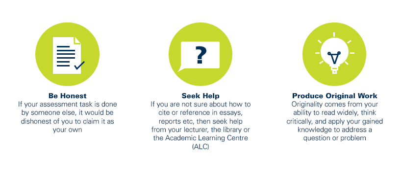
As a CQUniversity student you are expected to act honestly in all aspects of your academic work.
Any assessable work undertaken or submitted for review or assessment must be your own work. Assessable work is any type of work you do to meet the assessment requirements in the unit, including draft work submitted for review and feedback and final work to be assessed.
When you use the ideas, words or data of others in your assessment, you must thoroughly and clearly acknowledge the source of this information by using the correct referencing style for your unit. Using others’ work without proper acknowledgement may be considered a form of intellectual dishonesty.
Participating honestly, respectfully, responsibly, and fairly in your university study ensures the CQUniversity qualification you earn will be valued as a true indication of your individual academic achievement and will continue to receive the respect and recognition it deserves.
As a student, you are responsible for reading and following CQUniversity’s policies, including the Student Academic Integrity Policy and Procedure. This policy sets out CQUniversity’s expectations of you to act with integrity, examples of academic integrity breaches to avoid, the processes used to address alleged breaches of academic integrity, and potential penalties.
What is a breach of academic integrity?
A breach of academic integrity includes but is not limited to plagiarism, self-plagiarism, collusion, cheating, contract cheating, and academic misconduct. The Student Academic Integrity Policy and Procedure defines what these terms mean and gives examples.
Why is academic integrity important?
A breach of academic integrity may result in one or more penalties, including suspension or even expulsion from the University. It can also have negative implications for student visas and future enrolment at CQUniversity or elsewhere. Students who engage in contract cheating also risk being blackmailed by contract cheating services.
Where can I get assistance?
For academic advice and guidance, the Academic Learning Centre (ALC) can support you in becoming confident in completing assessments with integrity and of high standard.
What can you do to act with integrity?