Overview
This unit introduces you to engineering surveying techniques and spatial sciences. It outlines the fundamental principles of the plane and geodetic surveying, such as measurements of distances, elevations, and angles. You will learn surveying methods such as triangulation and traversing and use industry-relevant software QGIS or equivalent to develop skills in mapping and visualisation. This unit also introduces you to concepts related to automated survey instruments, errors and survey adjustments, computerised processing of survey data, and a range of advanced surveying tools such as GPS, laser scanners, and drones. You will also develop teamwork and communication skills necessary to implement such systems in the civil construction and mining industries.
Details
Pre-requisites or Co-requisites
Prerequisite: MATH11218 Applied Mathematics or MATH11160 Technology Mathematics.
Important note: Students enrolled in a subsequent unit who failed their pre-requisite unit, should drop the subsequent unit before the census date or within 10 working days of Fail grade notification. Students who do not drop the unit in this timeframe cannot later drop the unit without academic and financial liability. See details in the Assessment Policy and Procedure (Higher Education Coursework).
Offerings For Term 1 - 2025
Attendance Requirements
All on-campus students are expected to attend scheduled classes - in some units, these classes are identified as a mandatory (pass/fail) component and attendance is compulsory. International students, on a student visa, must maintain a full time study load and meet both attendance and academic progress requirements in each study period (satisfactory attendance for International students is defined as maintaining at least an 80% attendance record).
Recommended Student Time Commitment
Each 6-credit Undergraduate unit at CQUniversity requires an overall time commitment of an average of 12.5 hours of study per week, making a total of 150 hours for the unit.
Class Timetable
Assessment Overview
Assessment Grading
This is a graded unit: your overall grade will be calculated from the marks or grades for each assessment task, based on the relative weightings shown in the table above. You must obtain an overall mark for the unit of at least 50%, or an overall grade of 'pass' in order to pass the unit. If any 'pass/fail' tasks are shown in the table above they must also be completed successfully ('pass' grade). You must also meet any minimum mark requirements specified for a particular assessment task, as detailed in the 'assessment task' section (note that in some instances, the minimum mark for a task may be greater than 50%). Consult the University's Grades and Results Policy for more details of interim results and final grades.
All University policies are available on the CQUniversity Policy site.
You may wish to view these policies:
- Grades and Results Policy
- Assessment Policy and Procedure (Higher Education Coursework)
- Review of Grade Procedure
- Student Academic Integrity Policy and Procedure
- Monitoring Academic Progress (MAP) Policy and Procedure - Domestic Students
- Monitoring Academic Progress (MAP) Policy and Procedure - International Students
- Student Refund and Credit Balance Policy and Procedure
- Student Feedback - Compliments and Complaints Policy and Procedure
- Information and Communications Technology Acceptable Use Policy and Procedure
This list is not an exhaustive list of all University policies. The full list of University policies are available on the CQUniversity Policy site.
Feedback, Recommendations and Responses
Every unit is reviewed for enhancement each year. At the most recent review, the following staff and student feedback items were identified and recommendations were made.
Feedback from SUTE
The students would benefit from more on-time feedback on the assignments.
Timely feedback on assignments should be provided in the next offerings.
Feedback from SUTE UC's Reflection
Expanding the content and dedicating more time to developing software skills will better align the unit with current industry needs and enhance students' practical competencies.
Resources and time on QGIS should be expanded in future offerings.
- Recognise and discuss basic concepts and principles of engineering surveying and spatial sciences
- Perform spatial computations in two and three dimensions
- Apply surveying principles in civil and mining engineering works such as setting-out, earthwork calculations, and underground surveying
- Apply advanced techniques to perform spatial computations and solve a range of measurements and data management problems
- Demonstrate a professional level of communication and teamwork.
The Learning Outcomes for this unit are linked with the Engineers Australia Stage 1 Competency Standards for Professional Engineers in the areas of 1. Knowledge and Skill Base, 2. Engineering Application Ability and 3. Professional and Personal Attributes at the following levels:
Introductory
1.2 Conceptual understanding of the mathematics, numerical analysis, statistics, and computer and information sciences which underpin the engineering discipline. (LO: 1N 2N 3N 4N )
2.2 Fluent application of engineering techniques, tools, and resources. (LO: 1N 2N 3N 4N )
3.1 Ethical conduct and professional accountability. (LO: 2N 3N 4N 5N )
Intermediate
1.1 Comprehensive, theory-based understanding of the underpinning natural and physical sciences and the engineering fundamentals applicable to the engineering discipline. (LO: 1N 2I 3I 4N)
1.3 In-depth understanding of specialist bodies of knowledge within the engineering discipline. (LO: 1I 2I 3I 4N)
2.1 Application of established engineering methods to complex engineering problem solving. (LO: 1N 2I 3I 4N)
3.2 Effective oral and written communication in professional and lay domains. (LO: 1N 2N 3N 4I 5N )
3.4 Professional use and management of information. (LO: 3N 4I 5N)
3.6 Effective team membership and team leadership. (LO: 2N 3N 4N 5I)
Note: LO refers to the Learning Outcome number(s) which link to the competency and the levels: N – Introductory, I – Intermediate, and A - Advanced.
Refer to the Engineering Undergraduate Course Moodle site for further information on Engineers Australia's Stage 1 Competency Standard for Professional Engineers and course level mapping information https://moodle.cqu.edu.au/course/view.php?id=1511
Alignment of Assessment Tasks to Learning Outcomes
| Assessment Tasks | Learning Outcomes | ||||
|---|---|---|---|---|---|
| 1 | 2 | 3 | 4 | 5 | |
| 1 - Written Assessment - 20% | |||||
| 2 - Written Assessment - 40% | |||||
| 3 - Project (applied) - 40% | |||||
Alignment of Graduate Attributes to Learning Outcomes
| Graduate Attributes | Learning Outcomes | ||||
|---|---|---|---|---|---|
| 1 | 2 | 3 | 4 | 5 | |
| 1 - Communication | |||||
| 2 - Problem Solving | |||||
| 3 - Critical Thinking | |||||
| 4 - Information Literacy | |||||
| 5 - Team Work | |||||
| 6 - Information Technology Competence | |||||
| 7 - Cross Cultural Competence | |||||
| 8 - Ethical practice | |||||
| 9 - Social Innovation | |||||
| 10 - First Nations Knowledges | |||||
| 11 - Aboriginal and Torres Strait Islander Cultures | |||||
Textbooks
Engineering Surveying
Edition: 6th (2007)
Authors: W. Schofield and M. Breach
Taylor and Francis
London London , United Kingdom
ISBN: 978-0-7506-6949-8
Binding: Other
Surveying for Civil and Mine Engineers (Acquire the Skills in Weeks)
Edition: 2nd (2020)
Authors: John Walker and Joseph L. Awange
Springer
Bentley Bentley , WA , Australia
ISBN: 978-3-030-45802-7, 3030458032
Binding: Other
IT Resources
- CQUniversity Student Email
- Internet
- Unit Website (Moodle)
- QGIS Software
All submissions for this unit must use the referencing style: Harvard (author-date)
For further information, see the Assessment Tasks.
f.tahmoorian@cqu.edu.au
Module/Topic
Basic Concepts of Surveying
Chapter
- Chapter 1 of Surveying for Civil and Mine Engineers (Walker et al.)
- Chapters 1 & 2 of Engineering Surveying (Schofield and Breach)
Events and Submissions/Topic
Module/Topic
Levelling and its practical application
Chapter
- Chapters 2 & 3 of Surveying for Civil and Mine Engineers (Walker et al.)
- Chapters 3 & 8 of Engineering Surveying (Schofield and Breach)
Events and Submissions/Topic
Module/Topic
Distance Measurement
Chapter
- Chapter 4 of Surveying for Civil and Mine Engineers (Walker et al.)
- Chapter 3 of Engineering Surveying (Schofield and Breach)
Events and Submissions/Topic
Module/Topic
Angle Measurement
Introduction to QGIS
Chapter
- Chapter 4 of Surveying for Civil and Mine Engineers (Walker et al.)
- Chapter 5 of Engineering Surveying (Schofield and Breach)
Events and Submissions/Topic
Module/Topic
Traversing & Triangulation
QGIS- Vector data basics
Chapter
- Chapter 5 & 16 of Surveying for Civil and Mine Engineers (Walker et al.)
- Chapters 6 & 7 of Engineering Surveying (Schofield and Breach)
Events and Submissions/Topic
Module/Topic
MID-TERM BREAK
Chapter
Events and Submissions/Topic
Module/Topic
Earthworks (Quantities, Sections, Contours)
QGIS- Coordinate systems
Chapter
- Chapters 8 & 9 of Surveying for Civil and Mine Engineers (Walker et al.)
- Chapter 11 of Engineering Surveying (Schofield and Breach)
Events and Submissions/Topic
Module/Topic
Curves
QGIS- Working with vector data
Chapter
- Chapters 10, 11, 12 &13 of Surveying for Civil and Mine Engineers (Walker et al.)
- Chapter 10 of Engineering Surveying (Schofield and Breach)
Events and Submissions/Topic
Module/Topic
Setting out Works
QGIS- Raster data basic
Chapter
- Chapter 15 of Surveying for Civil and Mine Engineers (Walker et al.)
- Chapter 12 of Engineering Surveying (Schofield and Breach)
Events and Submissions/Topic
Module/Topic
Mine and Underground Surveying
QGIS- Create a map
Chapter
- Chapter 7 of Surveying for Civil and Mine Engineers (Walker et al.)
- Chapter 13 of Engineering Surveying (Schofield and Breach)
Events and Submissions/Topic
Module/Topic
Digital and Mass Survey Methods
Chapter
- Chapter 14 of Engineering Surveying (Schofield and Breach)
Events and Submissions/Topic
Module/Topic
Introduction of GPS and advanced surveying methods
Chapter
- Chapters 14 & 16 of Surveying for Civil and Mine Engineers (Walker et al.)
- Chapter 9 of Engineering Surveying (Schofield and Breach)
Events and Submissions/Topic
Module/Topic
Review
Chapter
Events and Submissions/Topic
Module/Topic
Chapter
Events and Submissions/Topic
Module/Topic
Chapter
Events and Submissions/Topic
1 Written Assessment
This assessment task relates to unit learning outcome 1. This assessment task aims to allow the students to demonstrate their understanding of various concepts and theories delivered in the unit during Weeks 1 to 4. This written assessment will constitute a number of questions (usually 6 to 8), similar to the unit tutorial questions, on the topics covered in the first four weeks of the term. All students are required to submit their written assessment individually and as a single PDF file for this assessment. The assignment questions will be made available on Moodle.
Week 5 Wednesday (9 Apr 2025) 11:59 pm AEST
Week 6 Wednesday (23 Apr 2025)
Each question in this assignment will be assessed separately for the criterion accuracy and correct results.
- Correct application of mathematics and arithmetic
- Answers clearly identified
- Correct results
In addition, the assignment as a whole will be assessed against the following criteria:
Evidence of correct procedures
- All necessary steps in analysis are present in correct order
- Clear presentation of mathematical and arithmetical working linking given details of the problem to the results obtained
- Evidence of checking results (mathematical, graphical, logic-common sense)
Evidence of understanding of the topic
- Explanation of choices made in the analysis (why is procedure required, why this particular procedure)
- Interpretation of results, eg limitations, direction of vectors
Professional presentation
- The work (job) is clearly identified (problem, date, analyst)
- Clear statement of each problem and its details and requirements
- Logical layout of analysis
- Appropriate use of diagrams, clear diagrams
- Correct use of terminology, conventions
- Clear English in the explanation of procedure and interpretation of results.
A similarity check will be always done before marking the submitted assignments for all students. Upon detection of any plagiarism including i) similarity between submitted reports within the same cohort or ii) with the previous cohorts or iii) submitted works to other institutes or iv) using the material provided by cheating websites will result in failing that assignment without marking and the student will be reported to the CQU Academic Misconduct team for further actions.
- Recognise and discuss basic concepts and principles of engineering surveying and spatial sciences
2 Written Assessment
This assessment task relates to the unit learning outcomes 1, 2, and 3. This assessment task aims to allow the students to demonstrate their understanding of various concepts and theories delivered in the unit until Week 10. This written assessment will constitute a number of small projects (usually 3 to 4) on the topics covered during the term for angle and distance measurement, area and volume calculation, contour map preparation, and earthwork estimation. All students are required to submit their written assessment individually and as a single PDF file for this assessment. Further details on the projects and assessment requirements will be provided on Moodle by Week 3.
Week 10 Wednesday (21 May 2025) 11:59 pm AEST
Week 12 Wednesday (4 June 2025)
Each project in this assignment will be assessed separately for criterion accuracy and correct results.
- Correct application of mathematics and arithmetic
- Answers clearly identified
- Correct results
In addition, the assignment as a whole will be assessed against the following criteria:
Evidence of correct procedures
- All necessary steps in the analysis are present in the correct order
- Clear presentation of mathematical and arithmetical working linking given details of the problem to the results obtained
- Evidence of checking results (mathematical, graphical, logic-common sense)
Evidence of an understanding of the topic
- Explanation of choices made in the analysis (why is the procedure required, why this particular procedure)
- Interpretation of results, eg limitations, the direction of vectors
Professional presentation
- The work (job) is clearly identified (problem, date, analyst)
- Clear statement of each problem and its details and requirements
- Logical layout of analysis
- Appropriate use of diagrams, clear diagrams
- Correct use of terminology, conventions
- Clear English in the explanation of procedure and interpretation of results.
A similarity check will be always done before marking the submitted assignments for all students. Upon detection of any plagiarism including i) similarity between submitted reports within the same cohort or ii) with the previous cohorts or iii) submitted works to other institutes or iv) using the material provided by cheating websites will result in failing that assignment without marking and the student will be reported to the CQU Academic Misconduct team for further actions.
- Recognise and discuss basic concepts and principles of engineering surveying and spatial sciences
- Perform spatial computations in two and three dimensions
- Apply surveying principles in civil and mining engineering works such as setting-out, earthwork calculations, and underground surveying
3 Project (applied)
This assessment task relates to the unit learning outcomes 2, 3, 4, and 5. It aims to allow the students to demonstrate their understanding of various concepts and theories delivered in the unit and develop a geospatial map using QGIS. The report should be prepared and submitted as a team. The report template and assessment details and requirements will be made available on Moodle by Week 5.
Week 12 Wednesday (4 June 2025) 11:59 pm AEST
After the final grade release
This assessment will be assessed for the:
- Accuracy of the Input parameter for each computation step with an appropriate unit.
- Application of accurate methodology with appropriate referencing. Full mark will only be awarded for error-free computational steps with appropriate explanation to be understood by an independent person;
- Accuracy of the answer with the appropriate unit;
- If answers to any preceding steps are inaccurate. A partial mark is awarded for subsequent answers;
- Correct application of mathematics and arithmetic;
- Clearly identified answers; and
- Correct results.
In addition, the assessment as a whole will be assessed against the following criteria:
- Evidence of correct procedures;
- All necessary steps in the analysis are present in the correct order;
- Clear presentation of the mathematical and arithmetical working linking is given;
- Details of the problem with the results are obtained; and
- Evidence of checking results (mathematical, graphical, logic common sense) are presented.
Evidence of an understanding of the topic:
- Explanation of choices made in the analysis (why is the procedure required, why this particular procedure); and
- Interpretation of results
A similarity check will be always done before marking the submitted assignments for all students. Upon detection of any plagiarism including i) similarity between submitted reports within the same cohort or ii) with the previous cohorts or iii) submitted works to other institutes or iv) using the material provided by cheating websites will result in failing that assignment without marking and the student will be reported to the CQU Academic Misconduct team for further actions.
- Perform spatial computations in two and three dimensions
- Apply surveying principles in civil and mining engineering works such as setting-out, earthwork calculations, and underground surveying
- Apply advanced techniques to perform spatial computations and solve a range of measurements and data management problems
- Demonstrate a professional level of communication and teamwork.
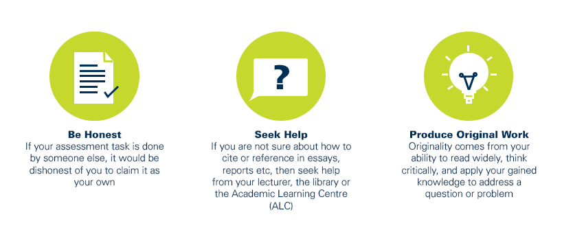
As a CQUniversity student you are expected to act honestly in all aspects of your academic work.
Any assessable work undertaken or submitted for review or assessment must be your own work. Assessable work is any type of work you do to meet the assessment requirements in the unit, including draft work submitted for review and feedback and final work to be assessed.
When you use the ideas, words or data of others in your assessment, you must thoroughly and clearly acknowledge the source of this information by using the correct referencing style for your unit. Using others’ work without proper acknowledgement may be considered a form of intellectual dishonesty.
Participating honestly, respectfully, responsibly, and fairly in your university study ensures the CQUniversity qualification you earn will be valued as a true indication of your individual academic achievement and will continue to receive the respect and recognition it deserves.
As a student, you are responsible for reading and following CQUniversity’s policies, including the Student Academic Integrity Policy and Procedure. This policy sets out CQUniversity’s expectations of you to act with integrity, examples of academic integrity breaches to avoid, the processes used to address alleged breaches of academic integrity, and potential penalties.
What is a breach of academic integrity?
A breach of academic integrity includes but is not limited to plagiarism, self-plagiarism, collusion, cheating, contract cheating, and academic misconduct. The Student Academic Integrity Policy and Procedure defines what these terms mean and gives examples.
Why is academic integrity important?
A breach of academic integrity may result in one or more penalties, including suspension or even expulsion from the University. It can also have negative implications for student visas and future enrolment at CQUniversity or elsewhere. Students who engage in contract cheating also risk being blackmailed by contract cheating services.
Where can I get assistance?
For academic advice and guidance, the Academic Learning Centre (ALC) can support you in becoming confident in completing assessments with integrity and of high standard.
What can you do to act with integrity?